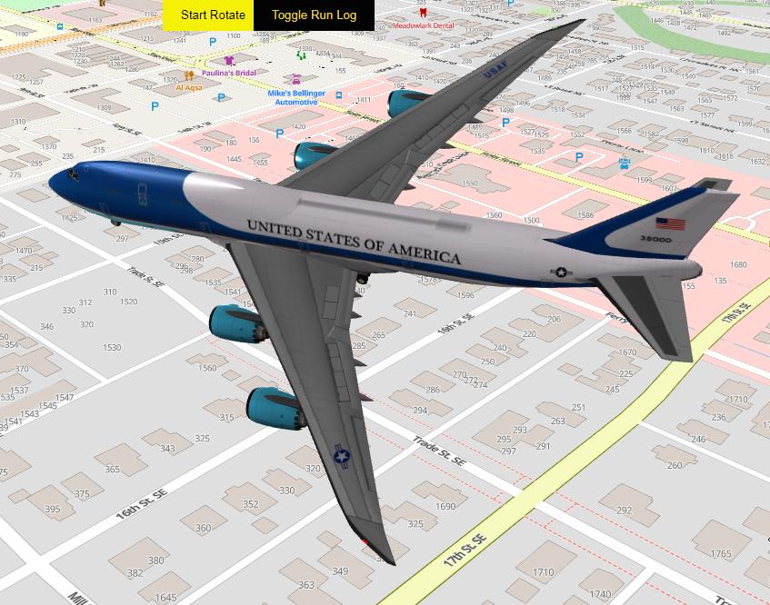
<p class="wp-block-paragraph">I have created a 3 dimensional model that depicts Air Force One (231′ long) buzzing Peck Cottage in a 1/2 mile radius going from an altitude of 100 to 500 and back to 100.</p>
<figure class="wp-block-image size-large wp-duotone-unset-2"><img src="http://salemdata.us/videos/2024-07-30_14-51-09.gif" alt="Air Force One @Peck Cottage"/></figure>
<p class="wp-block-paragraph">To accomplish this, I am using a vector tile server I built using the MapLibre <a href="https://martin.maplibre.org/">martin project </a>and <a href="https://threejs.org/">Threejs </a>JavaScript. What this will allow me to do is create simulations of actual flights I capture.</p>
<p class="wp-block-paragraph"></p>
<p class="wp-block-paragraph"></p>
<p class="wp-block-paragraph"></p>
I have created a 3 dimensional model that depicts Air Force One (231′ long) buzzing Peck Cottage in a 1/2 mile radius going from an altitude of 100 to 500 and back to 100.
To accomplish this, I am using a vector tile server I built using the MapLibre martin project and Threejs JavaScript. What this will allow me to do is create simulations of actual flights I capture.

Leave a Reply